Behind the Numbers
Here’s what you need to know about the annual Waterfowl Breeding Population and Habitat Survey
Here’s what you need to know about the annual Waterfowl Breeding Population and Habitat Survey

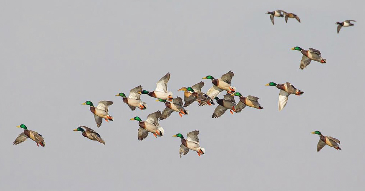
The results of the annual Waterfowl Breeding Population and Habitat Survey will be released some time in August. The data collected through this monumental effort are vitally important to the management of waterfowl across North America. Annual changes in duck and goose numbers have important implications for waterfowlers but do not necessarily influence hunting success. Weather and habitat conditions have a significant impact on waterfowl migration and distribution, and these variables often affect the fortunes of waterfowlers more than the size of the fall flight, especially in migration and wintering areas.
Read on to discover how your hunting seasons and bag limits are linked to surveys conducted each spring on the breeding grounds.
The history of the Waterfowl Breeding Population and Habitat Survey goes back more than 60 years to an experimental aerial survey conducted by the federal agency that would later become the U.S. Fish and Wildlife Service (USFWS). Today, the survey is the largest of its kind in the world, spanning some 2 million square miles and involving teams of biologists from the USFWS, state and tribal wildlife agencies, and Canadian Wildlife Service.
The survey territory stretches across the northern breeding grounds from Maine to the Dakotas and Montana and north into Canada and the Boreal Forest of the Northwest Territories and Alaska. Beginning in May, twelve teams of pilot-biologists and accompanying observers begin surveying waterfowl populations from the air across these key breeding areas. In all, 80,000 miles are covered by the teams, primarily from fixed-wing aircraft flying treetop high at a speed of roughly 100 miles-per-hour.
"Both the pilot-biologist and an observer in the seat to the right count waterfowl within a fixed distance from the aircraft, taking note of both the species and social grouping, say a single drake mallard or a pair of canvasbacks or a group of birds of the same species," explains Jim Dubovsky, with the USFWS's Division of Migratory Bird Management in Lakewood, Colorado. "The observer will also record the number of water bodies observed, separating them into categories of importance for breeding waterfowl, which is how the survey also provides an assessment of habitat conditions on the breeding grounds."
In areas of the Prairie Pothole Region, ground crews are also employed to shadow the air crews and count birds in a similar fashion, Dubovsky says, providing a correction factor that can be applied to data collected from the air throughout the survey area.
When the survey crews are finished, the data are sent to USFWS offices in Laurel, Maryland, where biometricians work with the pilot-biologists and ground crews to verify the raw data before running estimates for each region, which are then rolled into the final, complete report.
In addition to population estimates for many dabbling and diving duck species, the Waterfowl Status Report includes a mallard fall flight index, which provides an estimate for the fall population of midcontinent mallards.
"We have a sizable amount of data on mallards, which we have used to develop models that allow us to take a given years abundance of mallards and number of ponds and predict how many new birds will be recruited into the overall population," Dubovsky says. "We can then add that number to the number of birds that we saw in the spring and output what the fall flight will be, and that will be used to help set season regulations."
Dubovsky notes that the information gathered during the spring survey is used to set waterfowl hunting regulations for the following years.
"It is also important to note that the spring survey is just one of the tools we use to develop harvest regulations," Dubovsky says. "The data we collect from our banding program and our harvest survey programs are also vital to this process. Together, these three monitoring programs underpin so much of what we do to set regulations and provide as much harvest opportunities for hunters as we can."
All the monitoring data is incorporated into Adaptive Harvest Management models, which prescribe either a liberal, moderate, or restrictive season structure for each flyway. Federal officials, state waterfowl managers, and other members of the four flyway councils then meet to formally recommend hunting seasons and bag limits for the following season.
Hunters in the four flyways have enjoyed an unprecedented run of liberal season packages since 1995.
"The last long-term drought period that we had across the breeding grounds was in the late 1980s and early 1990s, when our bird counts were way down and we had more restrictive regulations," Dubovsky says. "Mother Nature has a lot to say about when and where these birds migrate, but in terms of having the habitat conditions needed to produce waterfowl, we've been in a good place for quite a long time."
Regardless of the conditions, the Waterfowl Breeding Population and Habitat Survey will continue to play a crucial role in providing guidance to the waterfowl managers who make the decisions that impact hunters and their days in the field and marsh.
"We're standing on the shoulders of the biologists who came before us and the work they've done," Dubovsky says. "I'm sure there's no way they could have envisioned how the methods they developed are being optimized today with the tools we have. Using the spring survey, the preseason banding program, and the harvest monitoring program together, we can make decisions for waterfowl and waterfowl hunters with more confidence."
Learn more about North American waterfowl.
Ducks Unlimited uses cookies to enhance your browsing experience, optimize site functionality, analyze traffic, and deliver personalized advertising through third parties. By continuing to use this site, you agree to our use of cookies. View Privacy Policy