Conservation Planning in the Playa Lakes
Facilitating planning using a Geographic Information System
Researchers
Stacey Shankle, Jerry Holden and Thomas Moorman, Ducks Unlimited Inc., Southern Regional Office, Ridgeland, Mississippi
Partners
Ducks Unlimited Inc., and the Playa Lakes Joint Venture
Background
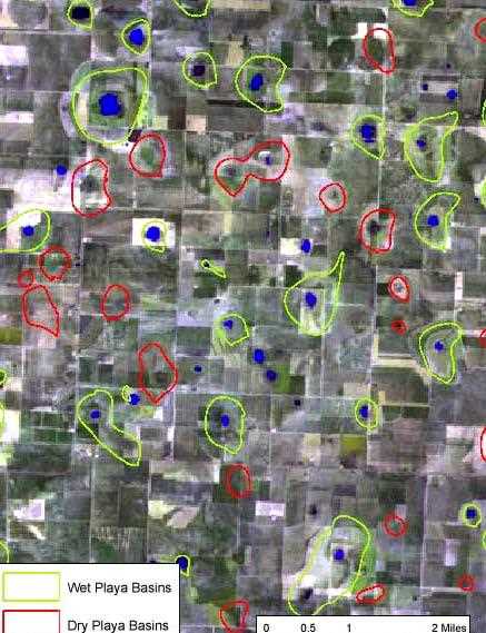
The Playa Lakes Joint Venture, established in 1989 as a result of the North American Waterfowl Management Plan, encompasses much of the Southern Great Plains. Ducks Unlimited, in partnership with the PLJV, developed a Geographic Information System that became operational in the summer of 2003. In particular, DU conservation planning staff inventoried playa lakes in the SGP by analyzing satellite imagery and digital elevation data. The PLJV GIS also includes numerous regional datasets, including a spatial database of PLJV conservation projects. The GIS, taken as a whole, will help direct conservation efforts to sites of highest ecological benefit. The results of this project will provide baseline data to further biological planning and facilitate tracking of PLJV conservation deliverables. Below are listed a few examples of the complex problems facing playa conservation in the SGP.
A major factor leading to the decline of playa systems is the common practice of pitting to concentrate and conserve rainfall and irrigation tailwater. These structural modifications severely alter the hydrology of playas, affecting their waterfowl and shorebird habitat values, their aquifer recharge rates, and other important ecological functions these wetlands provide. The practice of pitting is widespread, with estimates of upwards of 70% of playas having already been altered. The PLJV GIS, through its use of satellite image analysis during peak wet periods, can help regional conservation planners identify playas potentially altered to such a degree as to seriously diminish their hydro-period.
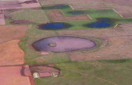
Another of the primary threats facing the ecological integrity of playa lakes is the practice of row cropping to the edge of and often directly through these sensitive wetlands. The practice of not observing grassland buffers dramatically increases playas' susceptibility to filling by sedimentation. The PLJV GIS aids planners in characterizing playas' threat status by their associated land use.